[toggles title=”Locations” (type=”accordion”) (style=”style2″) (with_image=”false” image_animation_type=”fadeIn|bounce|flash|pulse|rubberBand|shake|swing|tada|wobble|bounceIn|bounceInDown|bounceInLeft|bounceInRight|bounceInUp|bounceOut|bounceOutDown|bounceOutLeft|bounceOutRight|bounceOutUp|fadeInDown|fadeInDownBig|fadeInLeft|fadeInLeftBig|fadeInRight|fadeInRightBig|fadeInUp|fadeInUpBig|fadeOut|fadeOutDown|fadeOutDownBig|fadeOutLeft|fadeOutLeftBig|fadeOutRight|fadeOutRightBig|fadeOutUp|fadeOutUpBig|flip|flipInX|flipInY|flipOutX|flipOutY|lightSpeedIn|lightSpeedOut|rotateIn|rotateInDownLeft|rotateInDownRight|rotateInUpLeft|rotateInUpRight|rotateOut|rotateOutDownLeft|rotateOutDownRight|rotateOutUpLeft|rotateOutUpRight|slideInDown|slideInLeft|slideInRight|slideOutLeft|slideOutRight|slideOutUp|hinge|rollIn|rollOut” image_animation_duration=”{0-}”) ]
[toggle title=”Agia Galini” (collapsed=”false”) img_src=”” img_alt=”” img_width=”” img_height=””]
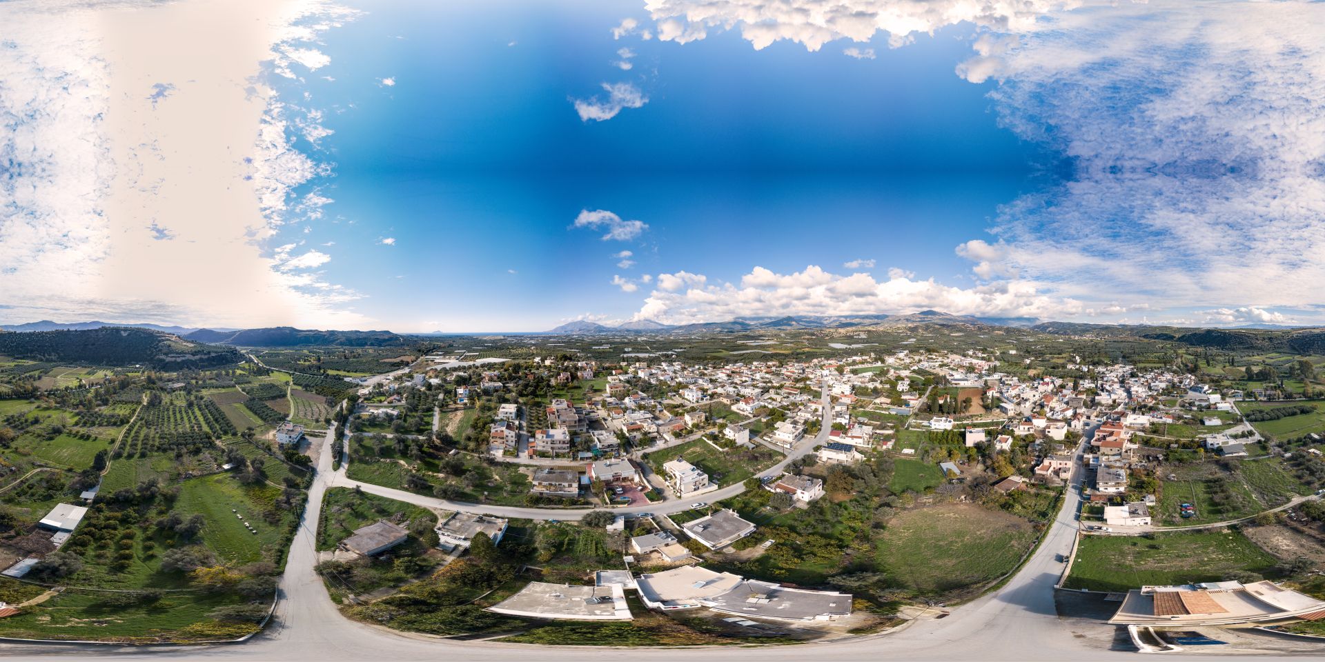
Agia Galini
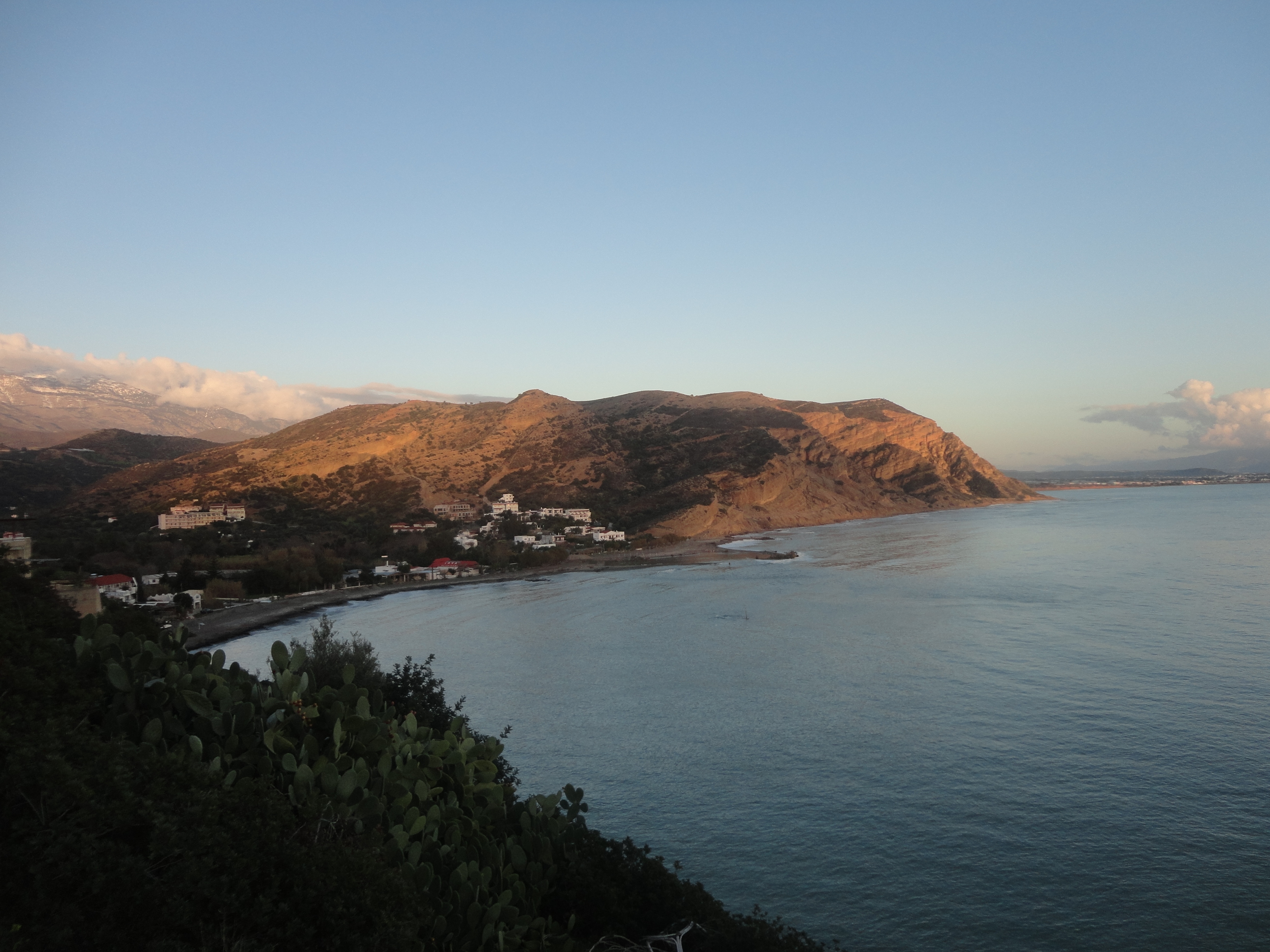
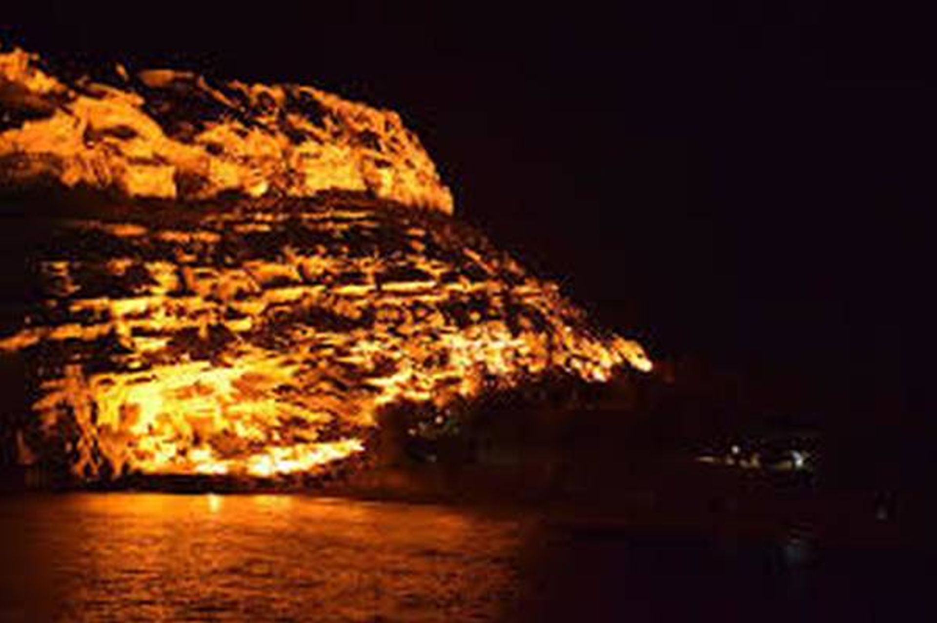
The village of Agia Galini (Αγία Γαλήνη meaning Holy Peace), has great scenery. Be impressed by the high cliffs, colourful Bougainville steps covered with flowers (sometimes very steep up- hill) and the Platis River flowing to sea with a backdrop of the snow-covered Idi Mountains. It is a charming fisherman’s village that also used to have a thriving timber and olive-oil trade with a soap factory until it changed to mainly tourism in the seventies of the last century. The houses are built amphitheatrically on the surrounding hills, overlooking the harbour. The seawater plays magically with the rays of the sun in several caves along the coast…
Agia Galini is a very family friendly place; apart from one main road the entire village is free of cars. The main road is not a thoroughfare; it leads only to the harbour. Besides lots of good restaurants and plenty of cosy bars with terraces, Agia Galini has all amenities like souvenir shops, clothing stores, jewellery shops, supermarkets, fruit and vegetables shops, two bakeries, a pastry shop, a laundry, a hairdresser, two masseurs, a fishmonger, a butcher, three car rental companies, a tour organization and two ATM machines to withdraw cash. Every summer season on National Holidays, “The Cultural Association of Agia Galini” organises several events in the harbour, like “The Fishermen’s feast” in June, “Folklore dancing with traditional Lyra music” in July and the grand “Popular Greek Music” concerts round the second week of August.
The origin of the name of the village
St. Galini, according to the Orthodox Church (Agia Galini in Greek), is said to have lived and been martyred in Corinth in the 3rd century AD and her feast-day is celebrated on the 16th of April. However, the name Galini is very rarely used in Greece. So how did this Cretan village come to have such an unusual name? There are various theories, all based on legend and guesswork. They may not give us a clear answer, but they add a note of mystery to the charm of unique Agia Galini.
According to the first theory, the name Agia Galini is can be traced to the Byzantine Empress Eudocia. At some time during the beginning of Byzantine times (round 441 AD), Eudocia (Athinais), wife of Emperor Theodosius II, on exile to Africa (fallen into disgrace through an unjust suspicion of infidelity) was caught in a storm in the gulf of Messara. She prayed to the virgin Mary for help. She safely reached the natural sheltered harbour shore of Soulia. She had made a vow and built a church in honour of the Virgin Mary. The church was named “Holy (Αγια) Virgin of serenity (Γαλήνη)”. The Byzantine church of the “Panagia” is in the cemetery of Agia Galini, overlooking the beach.
According to the second theory, when Christianity was established a Monastery of Galinios Christos (the Serene Christ) was built over the Temple of Artemis, and the village was named after it.
There is also, however, a third theory, which states that the area took its name from the phrase “Aei Galini” (“ever peace”), because the harbour is always calm and peaceful. Source (partially): explorecrete.com
(© Robert de Booij)
[/toggle]
[toggle title=”Faneromeni” (collapsed=”true”) img_src=”” img_alt=”” img_width=”” img_height=””]
Faneromeni
The small village of Faneromeni is located in the south part of Crete. It is located in a scenic location, in a verdant valley at the southern foot of Psiloritis mount with altitude of 80 meters.
The village is a magical place which beauty has been consolidated over the centuries and where time seems to stand still. Square, church, typical products, landscapes are just some ingredients of the list that make your holiday priceless in the typical Cretan Village of Faneromeni. You want miss out on local village cosiness.
Mini market, coffee shops, church gas station are in the village. Bigger supermarket, bank, etc. can be found on 8 kilometres distance in the village of Timbaki or Mires.
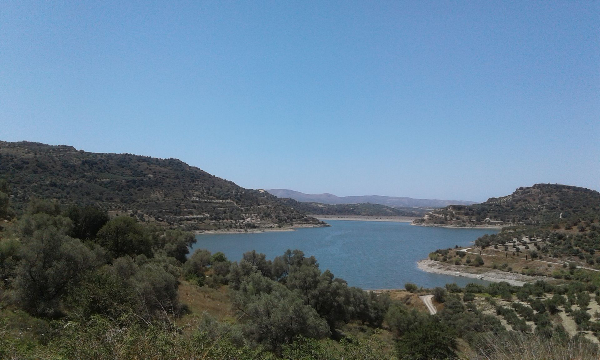
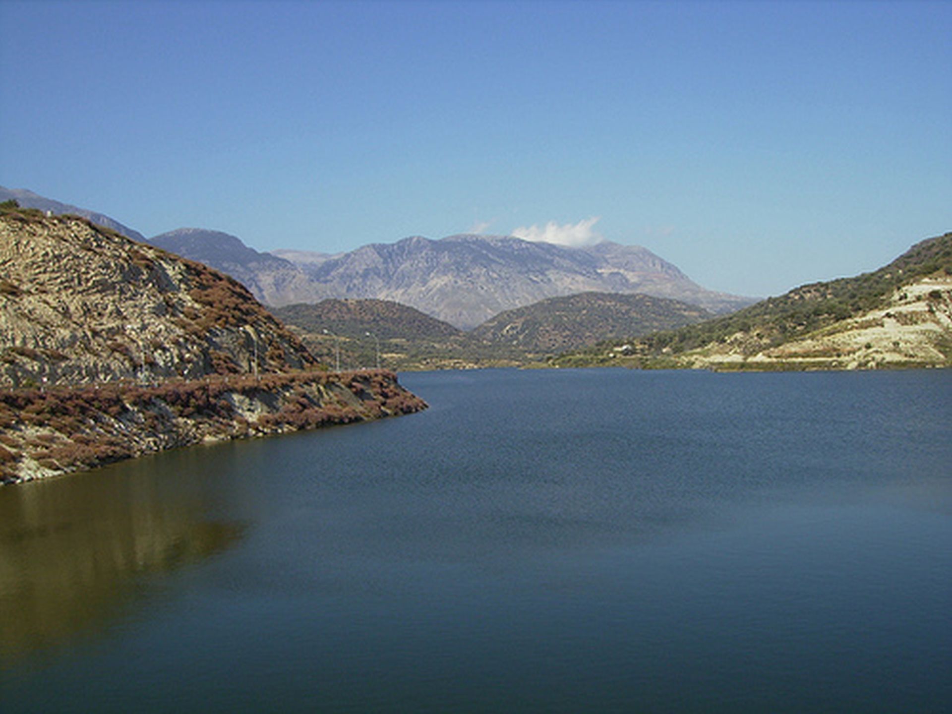
 The dam of Faneromeni is the gem of the village. The artificial lake covers an area of approximately 1000 acres and has a capacity of 20 million cubic meters. It was constructed in 2005 in order to meet the increased demand for irrigation of the Mesara plain. In those few years of operation, this lake of Faneromeni has become an extremely important wetland, where rare birds and animals nest. A walk in the dam during the spring is a wonderful experience.
</br ><br/>
[/toggle]
[toggle title=”Kalamaki” (collapsed=”true”) img_src=”” img_alt=”” img_width=”” img_height=””]
Kalamaki
The popular seaside village of Kalamaki is located in the prefecture of Heraklion in south Crete, between Agia Galini and Matala, only a few kilometers from Phaistos.
The visitors will be pleased as the village covers their needs. The village is built alongside the beach of the Messara bay. It has hotels, inns apartments and off course wonderful restaurants. All the required facilities are available in the village
- Souvenir shop
- Car rental companies
- Bakery
- Mini market
- Swimming pool
The village itself is expanding rapidly land inwards. Nevertheless his geographically central location in the southern part of Crete offers the advantage of an easy and quick access to the many archeological and touristic areas of the island.
[/toggle]
[toggle title=”Kalochorafitis” (collapsed=”true”) img_src=”” img_alt=”” img_width=”” img_height=””]
Kalochorafitis
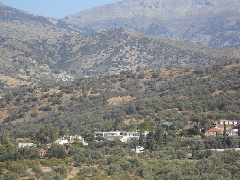
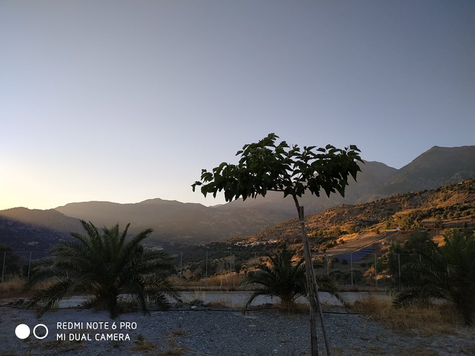
Kalochorafitis is a sleepy village on the southern slope of the Ida Mountains, on the edge of Messera level. The weather in southern Crete is sunnier than anywhere else in Europe, with high temperatures because of its proximity to North Africa and the Libyan Sea. It is located about 230m above sea level. The altitude ensures a light, cool breeze in high summer. In winter there is very little rainfall and the average temperature is between 15-20 ° C. Rarely the temperature drops in winter below 10 ° C.
The village offers an indescribable fantastic views of the Libyan Sea and the olive – embossed and orange trees landscape.
Of particular note are the panoramic views of the spring still snow-capped summit of Mount Idi.
The small idyllic village, surrounded by unspoilt nature, is the ideal residence for those seeking tranquility, hikers, nature lovers and individualists.
In Kalochorafitis can still discover the original Crete.
The healthy climate of a Cretan village close to the mountains, which is located just a short distance of the villages Zaros Kamares and Vori, is the perfect location for exploring the region.
Nearby there are important archaeological sites such as Gortyn, Phaistos and Agia Triada.
Dreamlike beaches like Kokkinos Pyrgos It has a beautiful sandy beach 2 km with crystal clear water 10 minutes drive away, Kalamaki 15 minutes drive away, Kommos 20 minutes drive away and Matala 20 minutes drive away. Timbaki is less than 10 minutes away by car. In Timpaki you can find all basic facilities, such as a supermarket, pharmacy, post office, bakery, ATM, gas station and taxi service.
Here it can be wonderful Cretan sun and the Libyan Sea to enjoy.
None of these beaches is crowded, mass tourism are nowhere.
In around Kalochorafitis are some traditional villages in which hosts many festivals with Cretan music and dance in the summer. To set your daily problems aside. Charge your batteries with sunshine so you can enjoy an unforgettable holiday.
[/toggle]
[toggle title=”Kamilari” (collapsed=”true”) img_src=”” img_alt=”” img_width=”” img_height=””]
Kamilari
Today Kamilari still offers traditional Cretan village life and very spectacular views. Spread on three hills with the names
- Ovgora, meaning “good view” is the highest one with an altitude of 110m;
- Goulas is the one with the old school and the Hellenistic findings on top and
- Alevrota the one with Alevrota villas on top, reachable from the village exit in direction of Siva
Kamilari is situated on the coordinates: 24°48′ East longitude and 35°03′ North latitude, and offers a panoramic 360° view on the Ida mountain range with Psiloritis, being the highest summit on the island with 2456m, to the North, Timbaki area to the West, the Messara plain to the East and the Lybian Sea to the Southwest. You can also see many other small and bigger villages around and on a day with a clear view you can even catch a view on the White Mountains and the island of Gavdos on the sea horizon.
Kamilari may not be directly on the sea, but it’s only a short distance from many beautiful local beaches. This minor disadvantage is more than made up for by the strongly traditional atmosphere of the village, with its pretty houses, picturesque alleyways and stunning views. In the narrow streets and alleyways of this old village you will find a real part of old Crete: two small main squares, three churches and three colorful kafeneios full of character, frequented by locals and visitors alike.
The old houses of Kamilari are built of stone, with lovely courtyards and bougainvilleas climbing the walls. Some of the houses you see have been restored by foreign owners, who use them as summer homes or rent them out to tourists. Kamilari preserves its traditional atmosphere, making it a lovely place to stay, stroll around and explore .
Kamilari belongs to the municipality of Phaistos with 23.882 inhabitants (57,86 inhabitants per square kilometre). Kamilari has the responsibility for the municipal administration on the three villages of Kamilari, Agios Ioannis and Kalamaki. The population of Kamilari district was stated in 2001 after the last census with 452 inhabitants. The next census will be at the end of 2011.
The Kamilari people are known for their hospitality, calmness and kindness. Many “Kamilarians” are still farmers or at least live from the animals they raise and what they grow in the garden, and they all follow the ecological balance approach. People, who grow vegetable and fruits, never use chemicals.
Kamilari still keeps it’s familiar atmosphere and is quite unspoilt from mass tourism although it offers many interesting sites in the local area like for example the popular archaeological sites of Agia Triada and Phaistos.
(© cultural comittee of Kamilari)
[/toggle]
[toggle title=”Kokkinos Pirgos” (collapsed=”true”) img_src=”” img_alt=”” img_width=”” img_height=””]
Kokkinos Pirgos
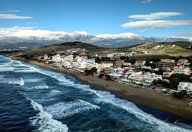
Kokkinos Pirgos is a small beach resort in the central south part of Crete. It is situated between Agia Galini and Matala and just one kilometer away from the town of Timbaki.
The small port of the village separates the beach into two parts. The west part unfolds till Agia Galini. This part is rough with rocks and pebbles. You can walk till Agia Galini by the coast. It takes up to two hours to reach your destination. You might need to cross some parts through the water (knee high). For sure you will meet some nudist sunbathing on this part of the beach.
The east part unfolds till Kommos and is called Kataliki. On the beach road are several cafes, taverns and restaurants. This part of the beach is organized with umbrellas and sunbeds. Mostly free of charge for the customers of the shops. Close to the rocks you have a safe and smooth enter into the sea. Recommendable for children!
At the end of the beach road you can find the large marsh of Kataliki. In spring you can admire the local fauna here.
The small harbor contributes to the nice holiday atmosphere of the village.
[/toggle]
[toggle title=”Lagolio ” (collapsed=”false”) img_src=”” img_alt=”” img_width=”” img_height=””]
Lagolio
Lagolio is located on the foot of Psiloritis, 6 kilometers away from the beach of Kokkinos Pirgos. It is an historical village with few houses and around 120 inhabitants. The patron saint of the village is the Saint Michalis, celebrating the 8th of November. You can find the older church (1899) at the other side of the village. In the village is one family operated tavern but no other shops. The old school is being renovated and will be soon a museum.
Lagolio is a perfect base for trips, very close to the many archaeological sites and a convenient spot for exploring the south of Crete with his beautiful beaches. Rental car is necessary to get around.
[/toggle]
[toggle title=”Lentas ” (collapsed=”false”) img_src=”” img_alt=”” img_width=”” img_height=””]
Lentas

Lentas is a picturesque coastal village 74 km south of Heraklion, to the south of the majestic Asterousia Mountains.
It is a tourist resort in a small harbor, moderately developed, offering opportunities for peaceful family holidays.
Access to the village lies through the asphalt road passing the villages Miamou and Krotos – a route that offers a breathtaking view of the Libyan Sea and the beaches of Lentas.
The name
The name is pre-Greek and is originated from the Phoenician word Lavi = Liondari (Lion) or from the ancient pre-Greek word Λέβυνθος (Levinthos). According to mythology, one of the lions who pulled the carriage of the Goddess Hera turned into a stone at this location, and that is why it was named Levin. But most likely the name Lentas originates from the fact that the adjacent cape resembles a head of a lion.
Archaeological significance
During the last excavations performed by Stylianos Alexiou, an Early Minoan settlement dating back to 2,500-1,900 BC was discovered, which supposedly had merchant relations with Egypt. Levin flourished in Greco-Roman period as a port of Gortyn, but also as a holy city where Asclepius was worshiped. The asclepeion was in its prime during the Roman Empire period.
The most ancient monument of Levin is a 1,090 meter-deep square well, dating back to the 2nd or 1st century BC. In the background of the sanctuary of Asclepius, an altar with the statues of Asclepius and Hygieia has been preserved.
[/toggle]
[toggle title=”Magarikari ” (collapsed=”false”) img_src=”” img_alt=”” img_width=”” img_height=””]
Magarikari
Location
Magarikari is located on an altitude of 450 meters on the flank of the Psiloritis Mountain. It has an amazing view to the Messara valley and the Lybian Sea.
History
Magarikari was first stated in history in 1583.
The village was partly destroyed by Turks, as they burnt hundreds of houses and desecrated the church of the settlement. During the German Occupation, the village was destroyed completely. During the occupation 47 of their residents were captured as hostages. While being transported to the mainland their ship was torpedoed and all of them drowned.
Georgios Petrakis, better known as the famous guerilla, Petrakogiorgis, was born in Magarikari in 1890. He was a Greek businessman, partisan, and politician. He was a leading figure in the Cretan resistance of the years 1941 – 1944 against the Axis occupation forces. He is well respected for his patriotism, courage, honesty, perspicacity and selflessness.
Churches
There are 4 churches in the village of Magarika :
- The one from Michael Archangel, celebrating the 8th of November
- The Exaltation of the Holy Cross – Timios Stavros, they day of commemoration is on the 14th of September. On this day they celebrate the cross itself, as the instrument of salvation.
- Panagia Kera celebrating on the 8th of September
- Agios Nektarios, celebrating on the 9th of November
Sightseeing
Worth visiting in the village are the ethnological little museum and the fountain at the entrance of the village. 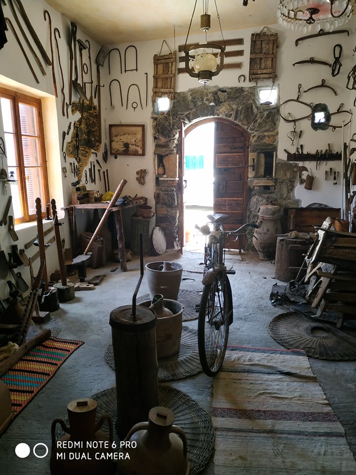
At the other end of the village you can find the Tower of Grammeni. It is one of the hundreds of fortresses built by the Turks in the 19th century to control the inland of Crete, and the Messara Passes, which seem to have been of great importance to them. The roofs of Grammeni are built on a hill near the main road with a wide field of view in every direction. It is a central coil, as it was called, with a rectangular shape with 24 loops.
The interior is divided into three parts with the east having an oven, a fireplace with a chimney and a dining area.
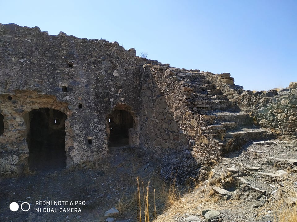 There are also fireplaces in the other two sections of the Tower which are 25×11 in total. Its walls are almost a meter thick and have been built with stones that were carried by a handful of Christian residents in the area.
The location of this tower is prominent and fortified as it is protected by a transverse shield with the exception of its north side, where it is also accessible.
Its courtyard was enclosed by a low wall, while in its northeast corner are the two-room ruins that may have served as accommodation for Turkish officers.
Within the courtyard there is and still is in good condition a rainwater tank (sarnitsi). In this water flowed from the roof of the building through a groove. Although locals say the particular tower was built on the ruins of a Venetian fortress, it has not been officially confirmed.
However, in May 1944 this building had been used by Magarikari residents as the Germans had destroyed their village and sought refuge in the cool place.
© e-storieskritis.gr
[/toggle]
[toggle title=”Maridaki beach ” (collapsed=”false”) img_src=”” img_alt=”” img_width=”” img_height=””]
Maridaki beach
The beach is remote. You can find two taverns nereby. There are no shops available here. More supplies and restaurants you can find in the neighboring village of Tsoutsouras.
When you are down at the beach it is worth to walk on the shoreline to find your own private small creek.
More or less 2 kilometers further on of the village you can find a small palm grove.It is known as the grove of Saint Athnony and is located close to the monastery of Saint Nikitas. It is formed along the creek starting at the springs of Kefalvrissi. For sure worth a visit.
There is an asphalt road going to Tsoutsouras. From there you can reach Maridaki beach by boat. There is a frequent connection between Tsoutsouras and Maridaki beach.
You can also walk up to Maridaki beach on the very well indicated walking path. You should count 20 to 30 minutes to reach the beach.
Off course you can also reach Maridaki beach by car. From Mesochori is a dirt track going down till the beach, a 45 minutes’ drive.
[/toggle]
[toggle title=”Matala ” (collapsed=”false”) img_src=”” img_alt=”” img_width=”” img_height=””]
Matala
Matala is a safe natural harbor in the south of Crete, at the edge of the Messara plain.
It is blessed with a gently sweeping sand and pebble beach.
The beach is 250m long and 45m wide.
Matala has something for everyone. Although it has become a popular tourist destination it still retains the charm and character of the quiet fishing village it started as at the beginning of the 20th-century, and the laid-back lifestyle of the hippies of the 60’s and 70’s lives on. Half the beach is fringed by tamarisk trees, leading the eye on to impressive formations of sandstone rock cliffs with their famous caves sliding into the sea at an odd angle, creating one of the most unusual beachscapes on the island.
In the Greek mythology is said that Matala is the place where Zeus swam ashore in the guise of a bull with Europa on his back.
There have been many pages of history here. Nobody knows quite who started caves but it seems likely that they were first hollowed out as Roman or early Christian tombs. There are other ruins at the eastern end of the village and if you go snorkeling in the clear waters of Messara Bay there are ancient ruins to be seen in the depths.
[/toggle]
[toggle title=”Mires ” (collapsed=”false”) img_src=”” img_alt=”” img_width=”” img_height=””]
Mires
The town of Mires is located 50km south of Heraklion in the heart of the fertile Mesara plain. Its name (means “shares” in Greek) is taken after the land shares that were offered by the Venetians to the settlers who came from the Peloponnese, when it fell to the Turks. A similar deal was done in the Lassithi Plateau, which’s name comes from the latin world Lasciti, ie the share of land.
Mires is a modern small city that is growing constantly, while its residents are mainly engaged in agriculture, animal husbandry, tourism and trade. Its position at the center of the fertile valley has given this dynamic development. The climate here is generally warm and the temperatures on the summer often exceed 40 ° C.
Because of the modern history of the town, its construction is quite chaotic and ugly. However, it is worth strolling through the old narrow streets in the town center. Moreover, on Saturdays thousands of people come from the villages of Messara to visit the largest flea market (bazaar) in Crete.
From Mires you can visit several places, such as the Roman Gortys, the Minoan Palace of Phaestus and Agia Triada, Matala of the hippies, the picturesque village of Pompia, the dam of Faneromeni, the villages on Psiloritis foot and the wild Asterousia Mountains.
( © Alexandros Roniotis)
[/toggle]
[toggle title=”Monochoro ” (collapsed=”false”) img_src=”” img_alt=”” img_width=”” img_height=””]
Monochoro
Monochoro is a quiet place at the edge of the Messara plain, at the foot of Psiloritis Mountain. It lies on an altitude of 190 meters and approximately 16 people live in this village.
It is a village with a continuous and uninterrupted history of more than 700 years. Not one house is sold to foreigners, the opposite applies; its people want to return and renovate the homes of their ancestors and even build new ones.
The first time the village was stated in writing was in a document as old as 1394, it is found in all known censuses already in 1577.
In the village lies the historic church of the Virgin Mary, celebrating on the 8 of September, solemnizing the Birth of Our Lady.
The founder of this church, Georgios Mousouris, is portrayed inside in hagiography on the back of a horse in a landscape of pomegranates. There are frescoes of inestimable value dating back to 1345 in the church. At the west end side is a half- ruined pranoos, while at the east of the entrance from the south you have the so called “Arcosolio”, which was a grave with a particular roof.
The Saint Gerasimos Kefallinia returned in 1548, after 20 years of absence, from Jerusalem to Zakynthos. He stayed for 2 years in a cave near the village and became a friar there. This place, which has since played the role of the church, is at short distance from the village.
The cave seems to be artificial, and the inside of the rock has been manually drawn. The solid rock is from “almond-stone”, this is easily deduced from the square of the shape. The cave is like a small room. It is 1.70 and 2.5 meters wide and long.
The cave is very difficult to find and almost impossible to enter.
Like tradition says, also Apostle Paul arrived in the village on one of his tours when he was travelling from Jerusalem to Rome. The combination of those two visits makes that the place is seen as sanctuary by the locals, and they even compare it with a little Mount Athos of the Messara plain.
[/toggle]
[toggle title=”Nivrito ” (collapsed=”false”) img_src=”” img_alt=”” img_width=”” img_height=””]
Nivrito
The mountain village of Nivritos belongs to the multiplicity of Rouvas. It has an altitude of 493 meters and has around 250 inhabitants. It is located between the two bigger villages of Zaros and Gergeri.
There is no doubt that water played a crucial role in this area. It was the base for wealth and livelihood. The irrigation system goes way back. This area provided Ancient Gortyn in the Roman years with water! The water was used for agricultural purposes, as well as for the watermills giving the possibility to the people to grind their cereals.
Nowadays there is very interesting event of the village that takes place on the 25th of March: the fair of Agios Methodios where the conveyance of the saint`s corps takes place in the escort of horseman. The yearly celebration of the patron saint of the church St Methodios takes place on the 20th of June.
A few kilometers further on you can find the cave hermitage of St Efthimios. Inside the hollow and large church are some frescoes. You also can find a rock- carving with the number 1432. Probably it is not referring to a date. In that time dates used to be written with letters.
Tradition says that Saint Efthimios was mistakenly killed by a hunter. The nuns of the monastery Saint Nikolaos saw him wandering in the gardens while he was dressed as an animal. The hunter mistakenly killed him. The outside area of the cave hermitage is the best location for a panoramic view.
[/toggle]
[toggle title=”Pitsidia” (collapsed=”false”) img_src=”” img_alt=”” img_width=”” img_height=””]
Pitsidia
Pitsidia is situated a short drive north east of Matala and Kommos or Komos beach, in the south of the Iraklion district. It’s not much more than the road that leads the people to these two other places and a few side streets. On the main road that leads through the village and around the central square you will find plenty of bougainville covered tavern’s where you can have a bite to eat, and there are a couple of supermarkets, a hairdresser, a butcher and a bakery. It’s got a charm of its own and it looks definitely better than some of the ugly villages you can see along the new national road. As you drive through the village on the main road you miss out on the actual old part of the village.
There are quite a few accommodations in the village of Pitsidia and is an option for people who want to visit the nearby beaches (Matala and Kommos) but want to avoid the crowds. Matala beach lies at a distance of four kilometer and Komos beach is one and a half kilometer away. You can walk from Pitsidia to this last beach in about 30 minutes. Yet another beach, the beach of Kalamaki lies at a distance of about 5 kilometer from the village. From Pitsidia there are regular buses to Matala beach (during high season 6 a day).
Pitsidia is the oldest village in the area. In Byzantine times the commander of the army settled in the village. The army came from the village of Pisidia, which is in the current Asia Minor (in the south of Turkey). This probably explains the name of the village still has today. Pitsidia was a logical place because there is a water spring in the hills behind the village. There are cisterns and water pipes behind the village hall, but nowadays these are no longer in use and the water comes into the village of Pitsidia through new pipes. There is still a small church dedicated to the water and two saints. This fairly new church has come in the place of an elder one, which was apparently so solidly built that the foundations had to be removed with dynamite.
© Hans Huisman
[/toggle]
[toggle title=”Pombia” (collapsed=”false”) img_src=”” img_alt=”” img_width=”” img_height=””]
Pombia
Pompia or Pombia is a fairly large and lively village that is located in the south of the Heraklion district. Most people will come through the village if they drive south from the town of Mires, which is five kilometers away, to the beach of Kali Limenes. The village itself is a village in which is lived and worked by the Greeks themselves and where inhabitants are not really concerned with tourism. In the center of Pompia most houses are in good shape. In the side streets you will see well maintained houses next to houses that are falling apart. There are elderly people, but also many families with children.
Pompia has about a thousand inhabitants and there are a number of squares, kafenions, taverns, grocery stores, mini markets and various large and small churches. For all other facilities residents can easily go to the larger village of Mires where there is a health center, and where every Saturday there is also a market. On the largest square in the village of Pompia are two big churches, a memorial to World War II and a memorial to the local hero Michalis Korakas, who was born in the village in 1797, became the chief commander of 12 eastern provinces of Crete, and played a prominent part in opposing the Ottoman occupation.
The patron saint of the village is Agios Georgios and one of the large churches is named after him. More interesting are the older smaller churches you encounter when walking through the village. A building higher up in the village, not far from the little white church that is built in the shape of a cross, makes the impression to be a very old church, but it appears to be a water source. The sculpted cistern that stands in front of the building, where the water comes in, with a kind of lion heads, could date from Venetian time or maybe even from an earlier period. There is an inscription and an image of patron saint Agios Georgios set in the building.
(© Hans Huisman)
[/toggle]
[toggle title=”Sivas” (collapsed=”false”) img_src=”” img_alt=”” img_width=”” img_height=””]
Sivas
Sivas is a village and homonym Municipal District of the Municipality of Festos in the Pyrgiotissis province of the south-western edge of the plain of Messara. It is situated at an altitude of 110 meters and is 62 kilometres from Heraklion. Near the village there is the well-known Monastery of the Virgin Odigitria.
The village is the birthplace of Saint John the Hermit or Saint Sir John. He worked for the resurgence of Orthodoxy in Crete after its liberation from the Saracens by Nikiforo Fokato 961. As conclusion we can say that the village existed already at this early age.
Several versions exist trying to explain the origin of the village name. The dominant version is the one explaining that the name “Sivas” derives from the presence of abundant natural resources in the area (the Arabic word “siva” means “source”). Another version claims that the village took its name from the Indian God. Others say it took his name from “Siwa”, the famous oasis of Egypt. This oasis is the place where the temple of Ammon Zeus is build, one of the place visited by Alexander the Great.
In the village of Sivas the visitor can enjoy the tranquillity and hospitality of the local people and the natural beauty of the environment. Don`t take it as a coincidence that a lot of locals after being abroad or away from their homes returned to settle in their village permanently now.
The view from the village to the magnificent mountain, taking the magical colours of the evening with the sunset, is just simply unique.
[/toggle]
[toggle title=”Skourvoula” (collapsed=”false”) img_src=”” img_alt=”” img_width=”” img_height=””]
Skourvoula
[/toggle]
[toggle title=”Treis ekklisies” (collapsed=”false”) img_src=”” img_alt=”” img_width=”” img_height=””]
Treis ekklisies
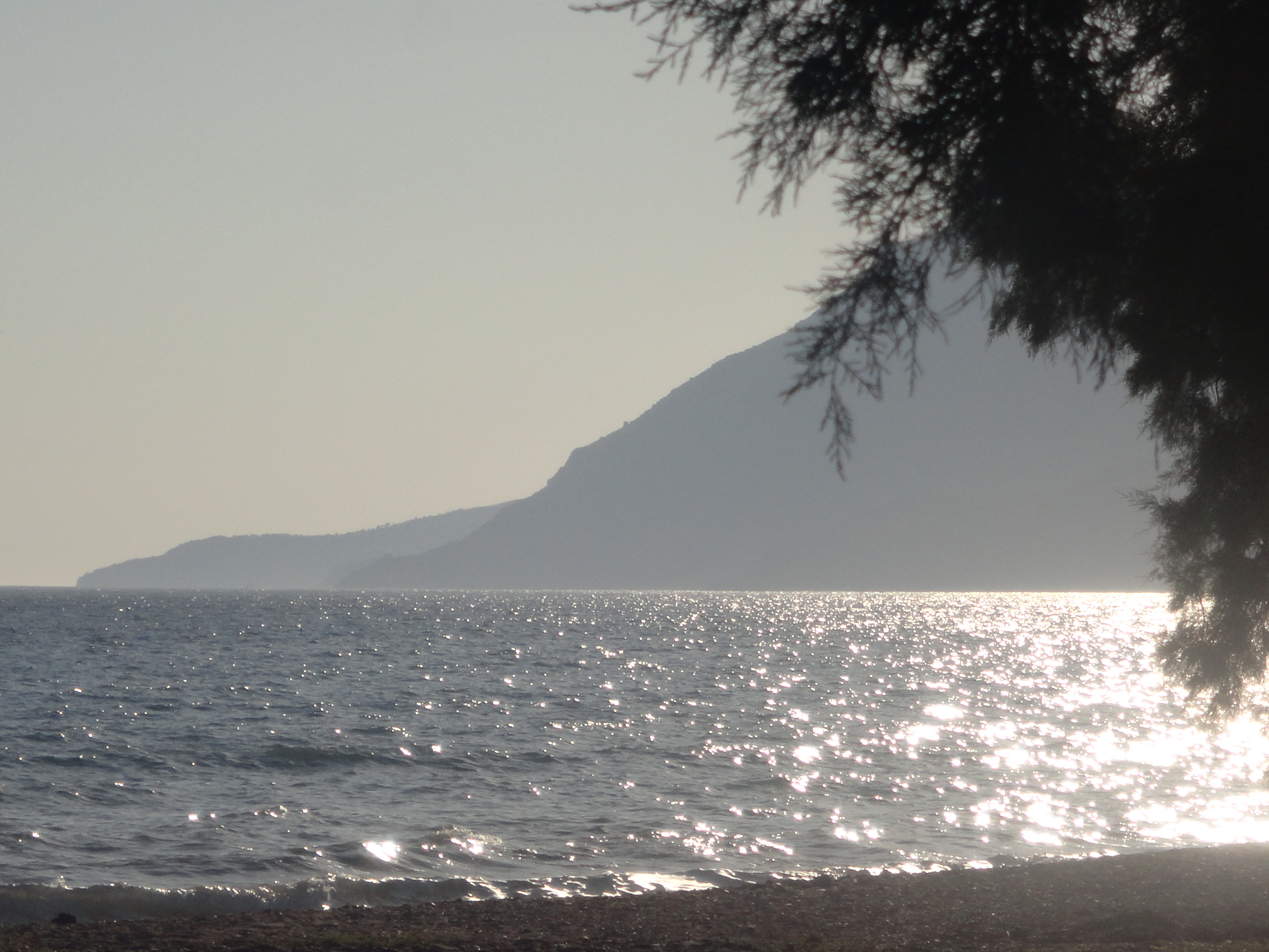
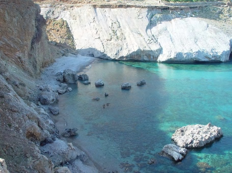
Treis Ekklisies (i.e. three churches) is a secluded seaside village located 64km south of Heraklion, amid the wild and inhospitable landscape of Asterousia Mountains. The surrounding area, one of the most isolated in Crete, is difficult to access, but hosts some of the most amazing beaches in Greece. To get to Treis Ekklisies you have to drive through a snake-like asphalt road with amazing sea views, about 10km long, starting from the village Paranymfi. In Paranymfi, you can visit the former monastery of Saint Paul with the old frescoes (14th century). Half a kilometer after Paranimfi, you can admire the stunning views of the Libyan Sea and Tris Ekklisies from the imposing waterfall of Ambas Gorge(145m high).
The settlement of Treis Ekklisies is built in a bay formed at the exit of the gorge of Ambas. The walls of the surrounding gorges are home to the largest colony of vultures in Greece and Southern Europe, including the bearded vulture, one of the rarest species of vulture in Europe.
The village took its name (Three Churches) after the three local Byzantine churches, dedicated to Transfiguration, St. George and Annunciation. In front of the hamlet, there is a long sandy beach with crystal clear deep water. The beach is not very well organized, but there are some rooms for rent, coffee shops and taverns nearby. If you head to the east (along the seaside dirt road) you will first reach the rock of Kolovrehtis with a small cove. Then is the beach Volakas and last Glikia Vlyhada, very popular to locals and free campers.
© Alexandros Roniotis
[/toggle]
[toggle title=”Vori” (collapsed=”true”) img_src=”” img_alt=”” img_width=”” img_height=””]
Vori
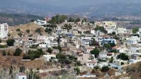
The charm of the village of Vori lies in its traditional character, the small village houses, centuries old, coloured with bright geraniums and bougainvillea. Strolling through the alleys will travel you to other times.
All houses are conveniently located on walking distance of the small centre of the village. All food products can be obtained on walking distance. The village provides with bakery, butcher, mini markets, restaurant and coffee shops. The public bus stops on the square of the village.
The village covers an area of 700 acres and it consists of two sections, the Lower village (Katochori) that is the traditional part of the village, and the upper village (Panochori) that is continuously growing since the beginning of the century.
History
The cultural inheritance of the village of Vori is very important and there are many sights and monuments worth visiting. Due to its unique beauty and historical importance, it was characterized by the Ministry of Culture of Greece a traditional protected village in 1978.
According to the tradition, the name of the village is derived from the name of the son of the king of Phaistos Radamantis, Voros.
Another explanation for the name Vori is its location (its located north of Phaistos ,”voras” meaning north in Greek) .
The village was populated continuously from the First-Minoan period (1800 BC) till today and this is certified by the numerous pottery that was found in the district of the village (Minoan, Hellenistic, Roman, Medieval, Renaissance).
Vori is the capital of the county of Pirgiotissas since the 17th century. In all the great Cretan revolutions, Vori participated actively.
In 1995, during a ceremony, Vori became a fraternized community with the communities of Camblanes and Meynac in France.
Sights & Cultural inheritance
The church of the Presentation of Virgin Mary.
The church is located between the old and the new village. It is an imposing church built during the years 1864-1881.
The temple of Agios Ioannis.
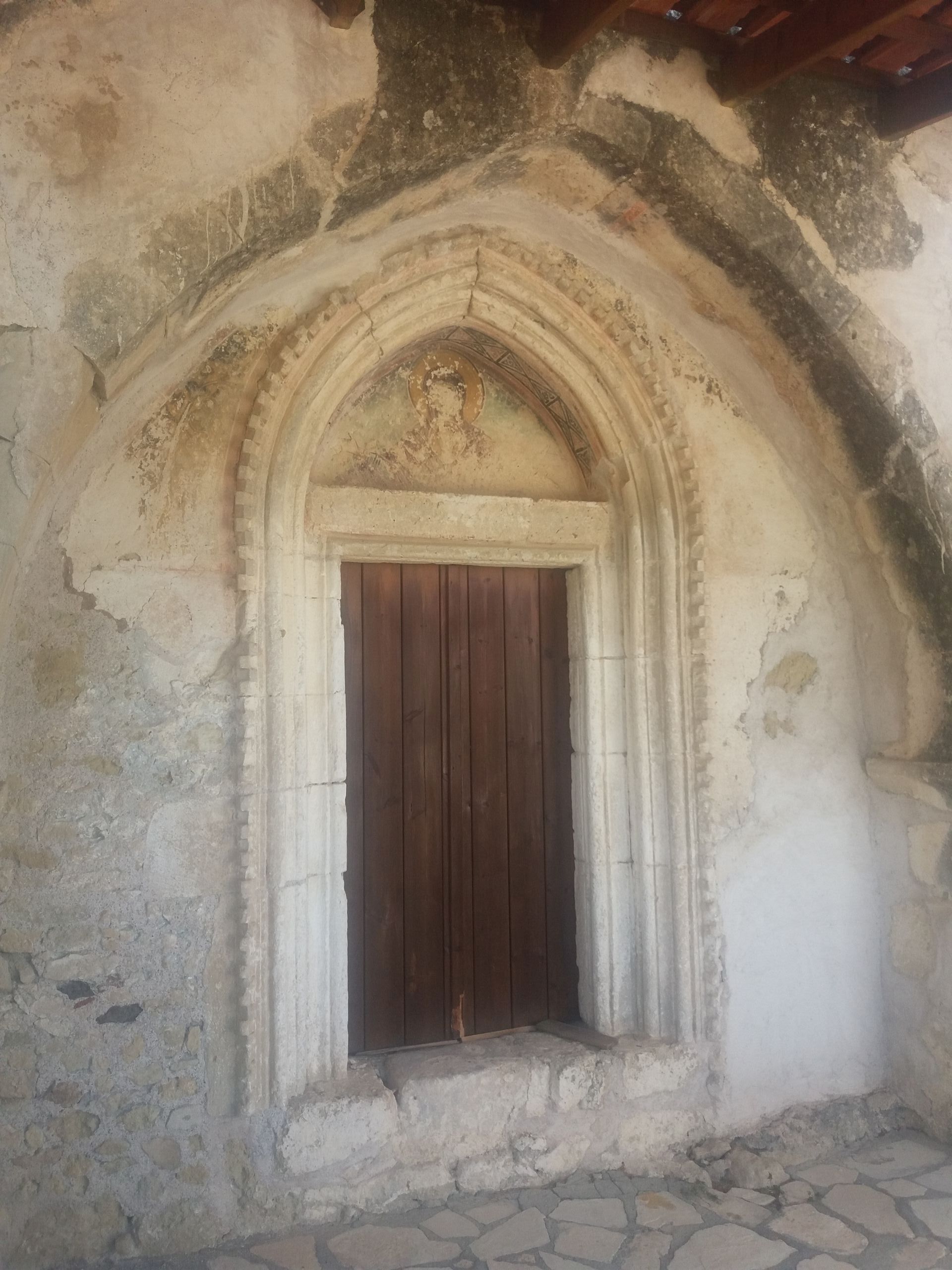
The temple of Agios Ioannis is a small domed temple in the center of the old village of Vori. The main temple was built around the 12th century while the church vestibule was built in the 13th-14th century. Today the temple is covered with tiles.
The inner temple used to be painted with frescoes, from which today are preserved only those of the dome and of the holy altar.
The church of Agia Pelagia.
The church is located at the western edge of the village and it was a cultural center during the renaissance period. It is a domed church dated from the 16th century.
Loutro
East of the village, in the location the called Loutra (baths), there is a domed stoned building, that is believed to be a Turkish bath. In all the surrounding area various pieces of pottery have been found.
Towers
In the village there are two towers dated from the renaissance period. The first one is placed northwest of the village. From this tower only the ground floor is saved today, on which a neoclassical house is built. The second one is placed north of the church of Agia Pelagia and is saved intact, as it was after some restoration during the Turkish occupation.
There is also a Turkish tower, built east of the village in the location called Koules. The tower housed a small military garrison.
Outside the village but within the limits of the municipality of Vori are some unique monuments.
The monastery of Panagia Kardiotissa
It was built in the 15th century adorned with wonderful frescoes.
The monastery today is deserted. Its peak can be traced during the Venetian occupation. It was probably destroyed during the siege of Iraklion by the Turks (1645-1669).
In accordance to the tradition the icon of Panagia (Holy Mother) was found under an olive tree. This tree was sacred and its leaves were supposed to be a cure for the illness for those who wore them as amulet.
The domed temple of Agios Georgios Kontaras built in the 12th century also painted with frescoes.
The temple of Agia Fotini and the temple of Agia Paraskevi built in the 15th century.
There is also a unique in Crete water mill, called Gerontomilos, built in the 16th century. The settlement contains two wells and the house of the miller.
(© : interkriti.org)
[/toggle]
[/toggles]